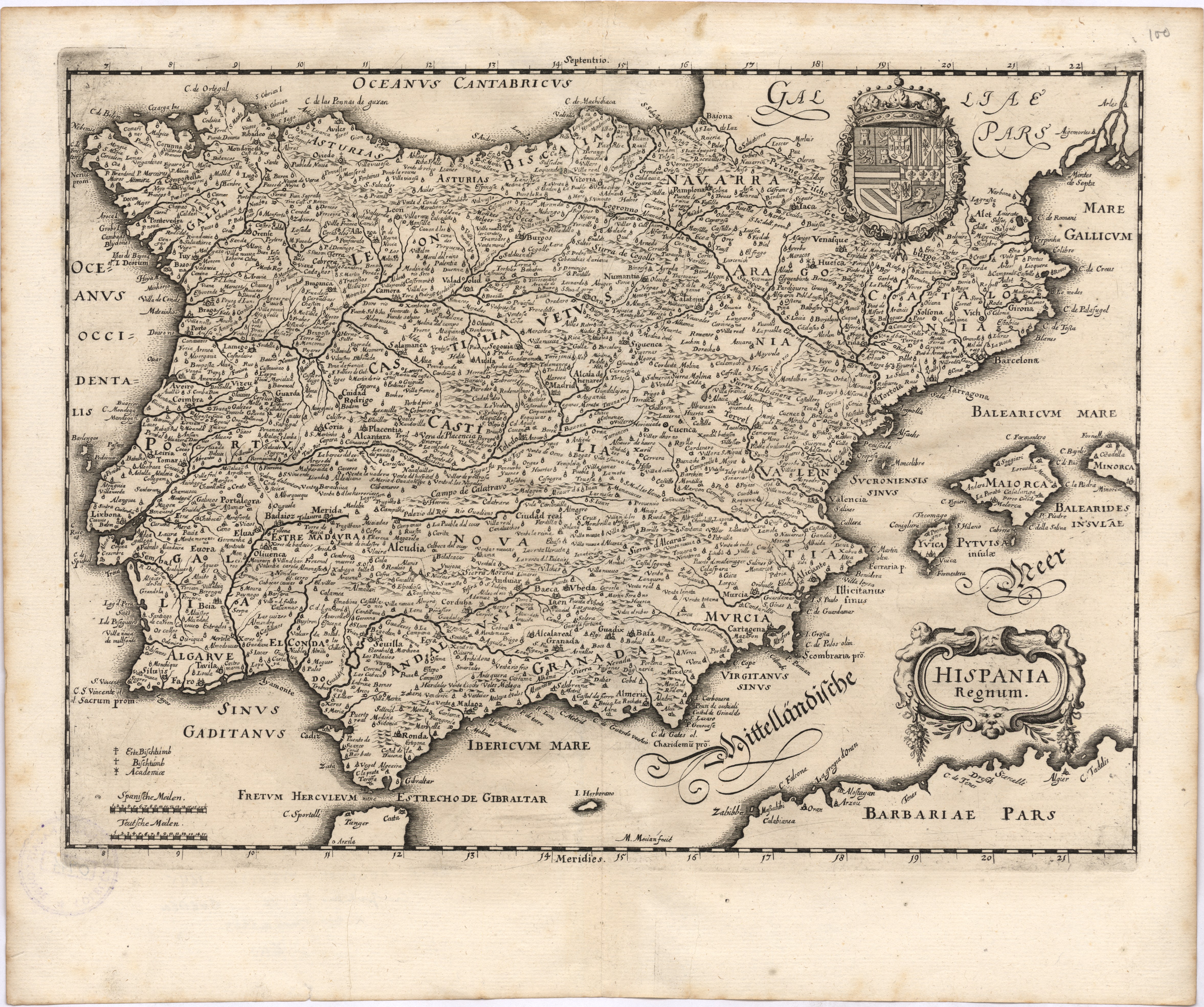
 | A correct map of Spain & Portugal
 : according to the newest observations and discoveries comunicated to the Royal Society at London and the Royal Academy at Paris is humbly dedicated to the Right Honorable Iohn Ld. Somers Baron of Evesham / by your Lordships most Obedient Servants I. Maxwell & I. Senex Geographers to the Queen. . - [London]: I. Maxwell & J. Senex, [1710?] . - 1 mapa | Maxwell, John, ed. com.; Senex, John, ca. 1678-1740, ed. com. | Entidade: UC | Ver na fonte | Cópia digital | Link persistente deste registo: http://id.bnportugal.gov.pt/bib/rnod/318926 |
|  |
 | The Western Isles
 / sold by J. Mount and T. Page . - London, Tower Hill: J. Mount and T. Page, [176-?] . - 1 mapa | Mount & Page, | Entidade: UC | Ver na fonte | Cópia digital | Link persistente deste registo: http://id.bnportugal.gov.pt/bib/rnod/318925 |
| |
 | | |
 | Bonne, Rigobert, 1727-1794, cartogr., e outro(s)
| Plan de la Baye d'Awatska sur la Côte Orientale du Kamtschatka : Partie du Japon ou Nipon ; Plan du Typa ou de Macao ; Plan du Havre de St. Pierre et St. Paul ; Isle de Soufre / André sculp . - [Paris]: [Panckoucke], [1788] . - 4 mapas numa f. | Bonne, Rigobert, 1727-1794, cartogr.; André, grav. aguaf. | Entidade: UC | Ver na fonte | Cópia digital | Link persistente deste registo: http://id.bnportugal.gov.pt/bib/rnod/318923 |
| |
 | Chart of the Açores (Hawks) Islands, called also Flemish and Western Islands.
 . - London: Printed for Robert Sayer as the Act directs, [179-?] . - 1 mapa | Sayer, Robert, 1725-1794, impr. | Entidade: UC | Ver na fonte | Cópia digital | Link persistente deste registo: http://id.bnportugal.gov.pt/bib/rnod/318922 |
| |
 | | |
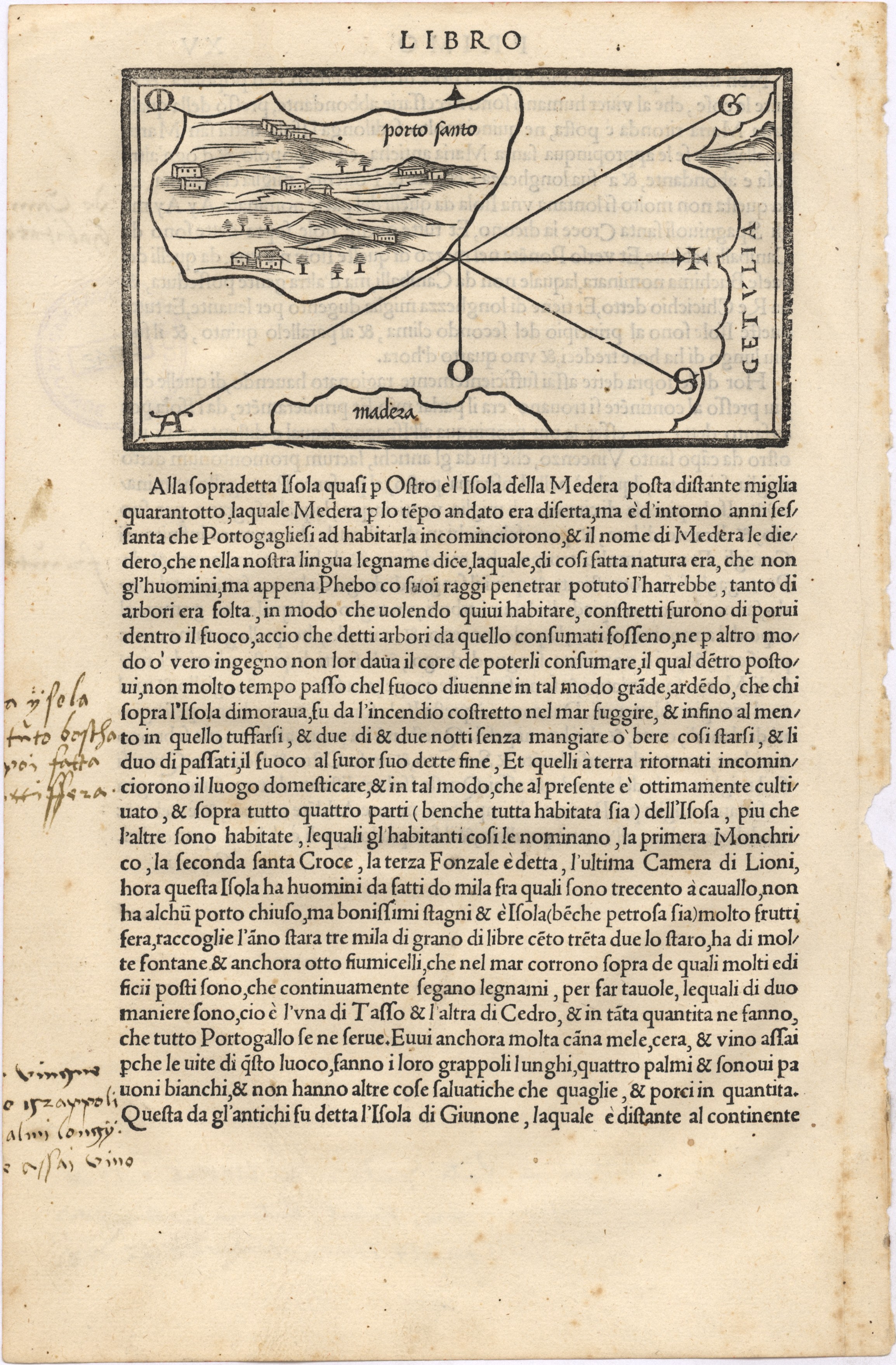 | | |
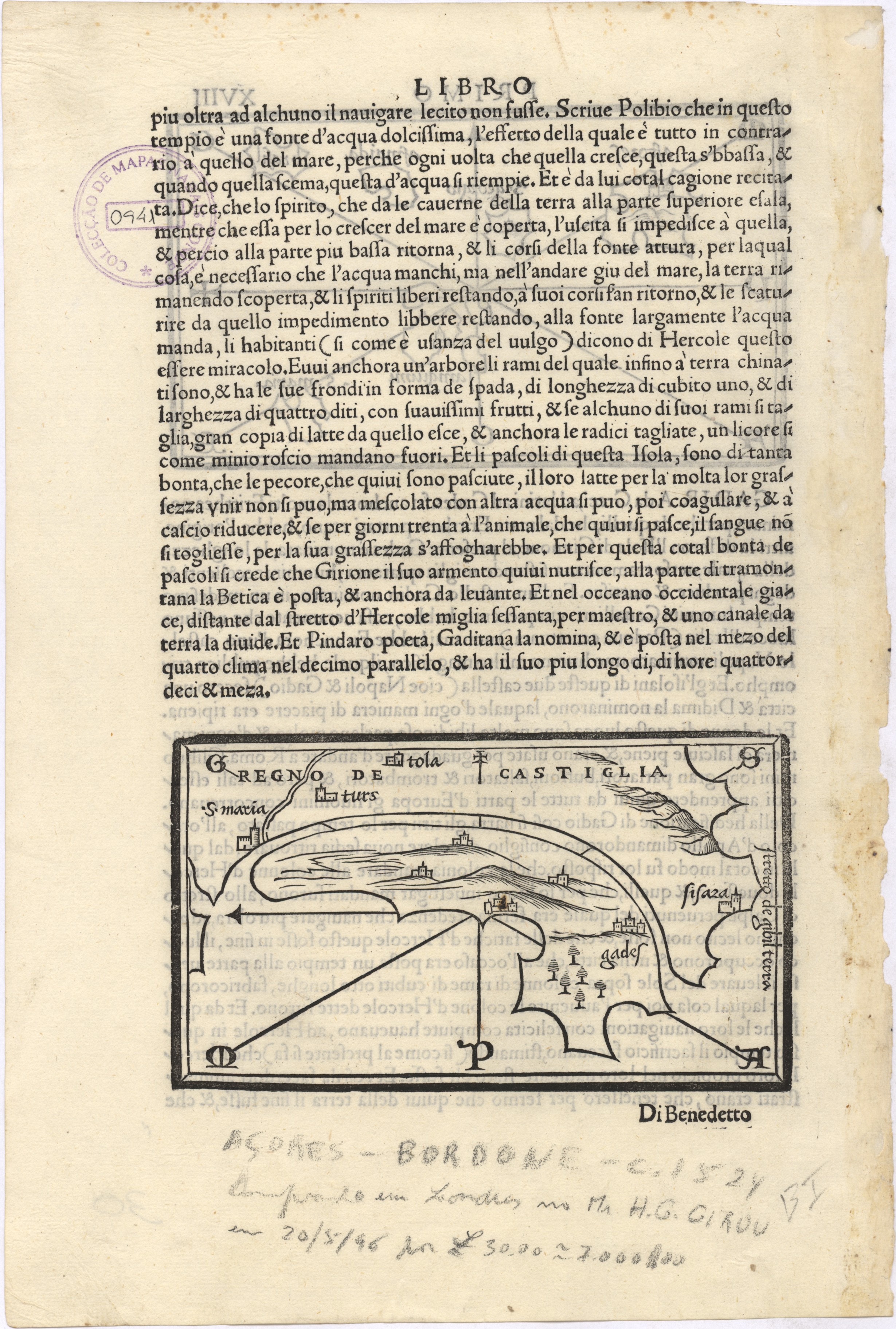 | Bordone, Benedetto, 1460-1531, cartogr.
| [Isolario] : azores, s. georgio, asmaida, brasil, sanguini, s. maria / [Benedetto Bordone] . - [Venice]: [s.n.], [c. 1524] . - 1 mapa | Bordone, Benedetto, 1460-1531, cartogr. | Entidade: UC | Ver na fonte | Cópia digital | Link persistente deste registo: http://id.bnportugal.gov.pt/bib/rnod/318919 |
| |
 | Carte Historique et Geographique des Royaumes D'Espagne et de Portugal :{u200E}{u200E}
 : Divises selon leurs Royaume et Provinces / [Henri Abraham Chatelain] . - [Amesterdão]: [Henri Abraham Chatelain], [1708] . - 1 mapa | Châtelain, Henry Abraham, 1684-1743, cartogr. | Entidade: UC | Ver na fonte | Cópia digital | Link persistente deste registo: http://id.bnportugal.gov.pt/bib/rnod/318918 |
| |