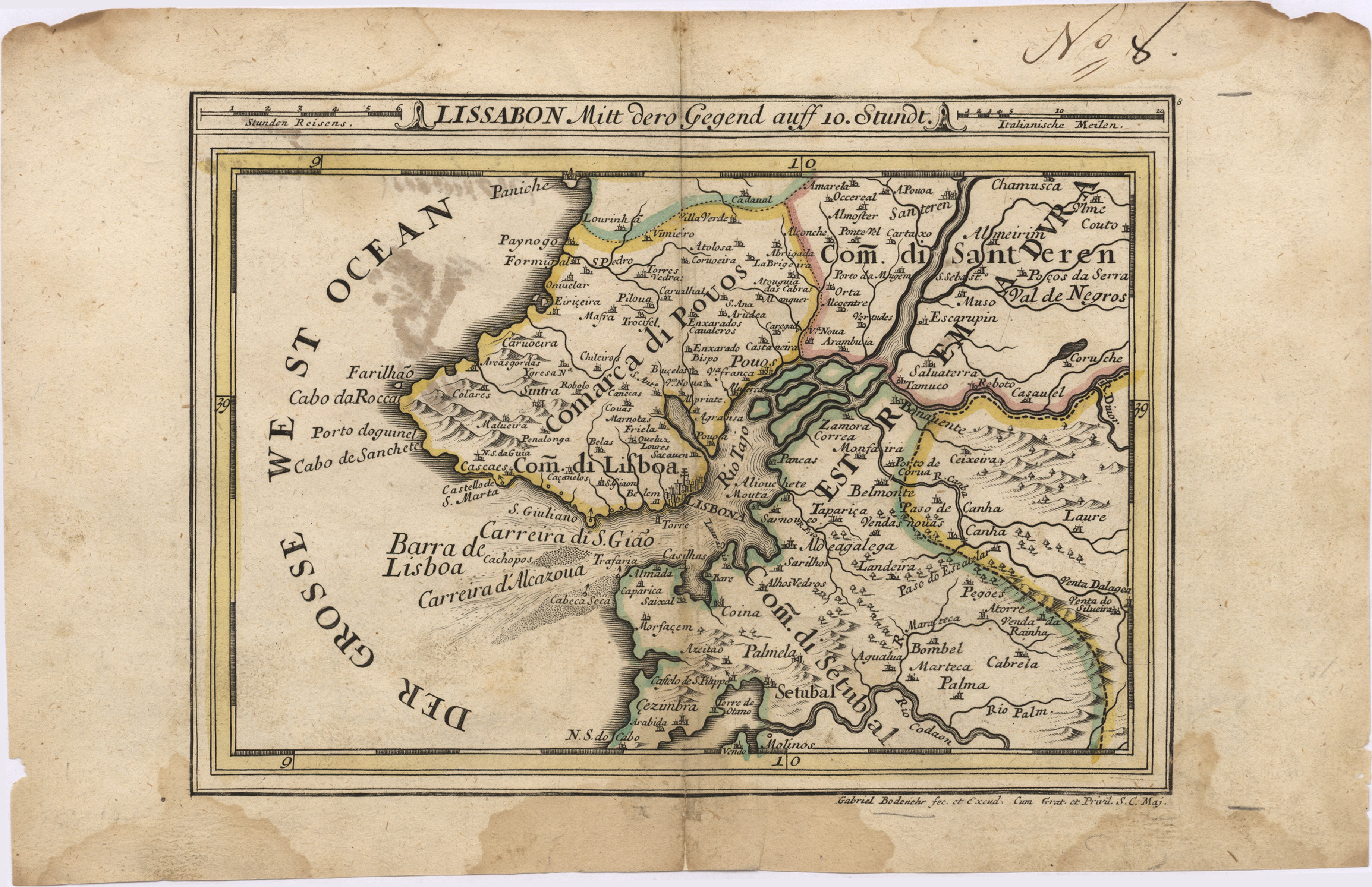
 | Bodenehr, Gabriel, 1673-1765
| Lissabon Mitt dero Gegend auff 10. Stundt / Gabriel Bodenehr fec. et Excud cum Grat. et Privil. S. C. Maj. . - [Augsburg]: [G. Bodenehr], [1720] . - 1 mapa | Bodenehr, Gabriel, 1673-1765 | Entidade: UC | Ver na fonte | Cópia digital | Link persistente deste registo: http://id.bnportugal.gov.pt/bib/rnod/319076 |
|  |
 | Richards, George Henry, 1820-1896, cartogr., e outro(s)
| West coast of Spain and Portugal : Cape Finisterre to Cape St. Vincent : compiled from the latest information in the Hidrographic Office to 1881 / under the Superintendence of Rear Admiral G. H. Richards; engraved by Edwd. Weller . - Large corrections. . - London: Published at the Admiralty, 1904 . - 1 mapa | Richards, George Henry, 1820-1896, cartogr.; Weller, Edward, m. 1884, grav. aguaf. | Entidade: UC | Ver na fonte | Cópia digital | Link persistente deste registo: http://id.bnportugal.gov.pt/bib/rnod/319075 |
| |
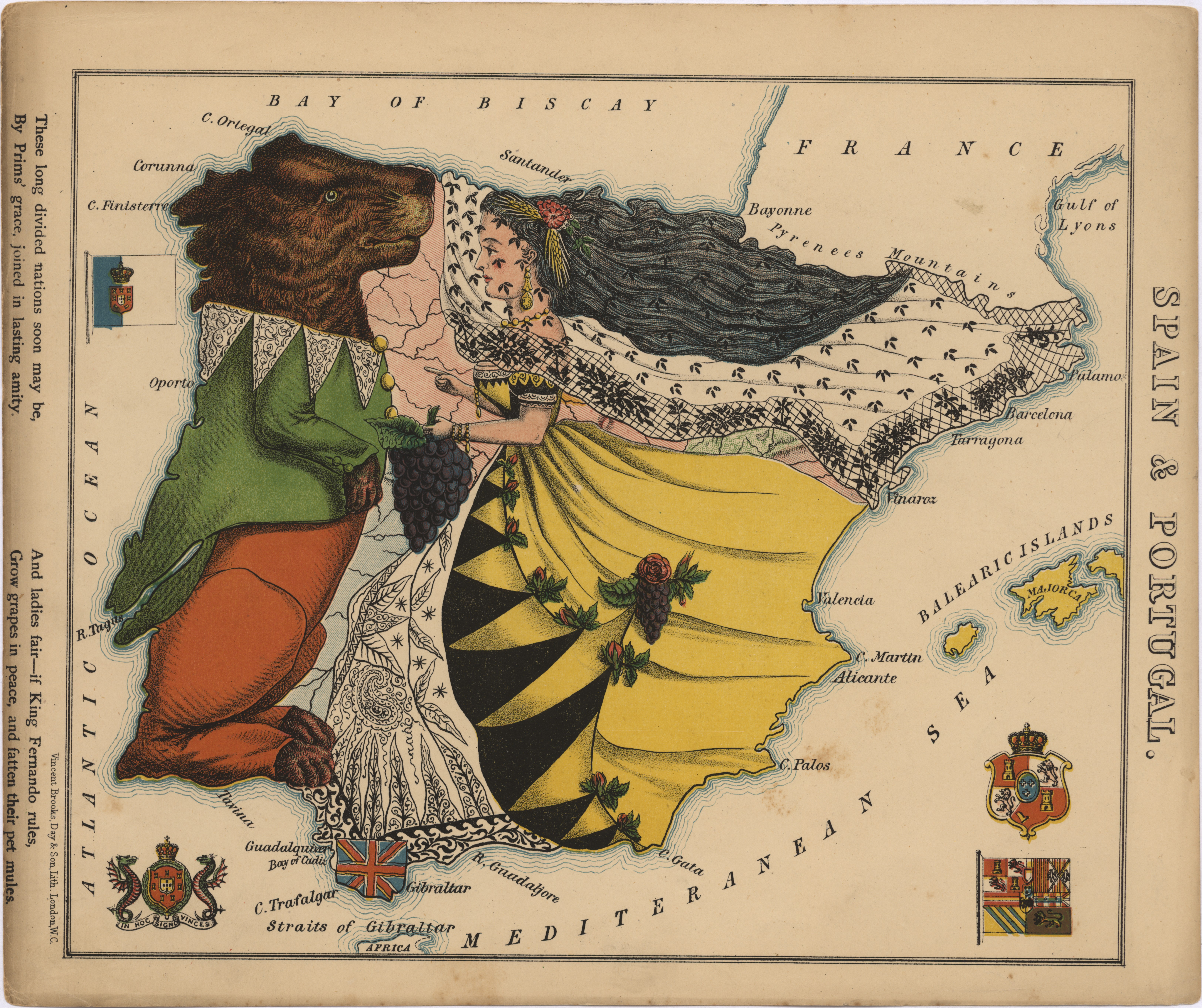 | Harvey, William, 1796-1866, e outro(s)
| Spain & Portugal / William Harvey "Aleph"; [artist / map designer Lilian Lancaster]; Vincent Brooks, Day & Son Lithographers . - London: Hodder & Stoughton, 1868 . - 1 mapa | Harvey, William, 1796-1866; Lancaster, Lilian, il.; Brooks, Vincent, grav. aguaf.; Day & Son, | Entidade: UC | Ver na fonte | Cópia digital | Link persistente deste registo: http://id.bnportugal.gov.pt/bib/rnod/319074 |
| |
 | Mapa de Portugal Ilhas e Colónias
 / edição de J. R. Silva. . - Edição popular . - Lisboa: Lito. Costa & Valério, 1952 . - 1 mapa | Silva, J. R., ed. lit. | Entidade: UC | Ver na fonte | Cópia digital | Link persistente deste registo: http://id.bnportugal.gov.pt/bib/rnod/319073 |
| |
 | Read, W. Harding, cartogr., e outro(s)
| Chart of the Island of St. Michael / with permission is most respectfully inscribed by his obedient servant W. Harding Read; Stephenson, engraver . - London: Published as the Act Directs by William Heather, 1808 . - 1 mapa | Read, W. Harding, cartogr.; Stephenson, John, fl. 1786-1800, grav. aguaf. | Entidade: UC | Ver na fonte | Cópia digital | Link persistente deste registo: http://id.bnportugal.gov.pt/bib/rnod/319072 |
| |
 | Calmet-Beauvoisin, Marie-Antoine, fl. 1772-18--, cartogr.
| Plan de Lisbonne : son port, ses rades et ses environs avec une petite carte routière du Portugal / dressés par le Ch.er Calmet-Beauvoisin auteur du Grand Atlas en 63 feuilles. . - [Paris]: Lith. de Delarue, [1833] . - 1 mapa | Calmet-Beauvoisin, Marie-Antoine, fl. 1772-18--, cartogr. | Entidade: UC | Ver na fonte | Cópia digital | Link persistente deste registo: http://id.bnportugal.gov.pt/bib/rnod/319071 |
| |
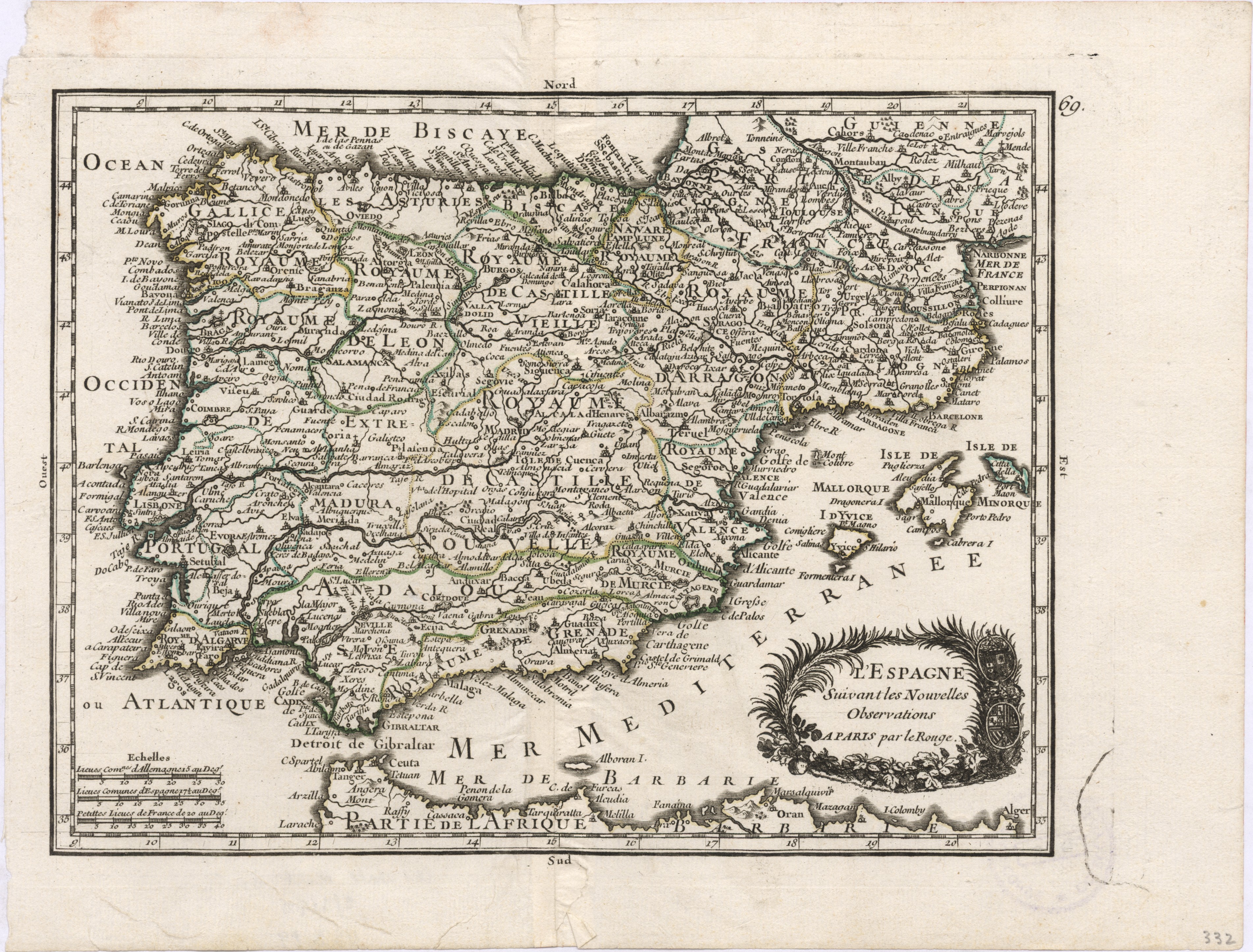 | | |
 | Bonne, Rigobert, 1727-1794, cartogr., e outro(s)
| Les Royaumes d'Espagne et de Portugal / par M. Bonne , Ing.r Hydrographe de la Marine; André sculp . - [S.l.]: [s.n.], [1788] . - 1 mapa | Bonne, Rigobert, 1727-1794, cartogr.; André, Gaspard, fl.1771-1801, grav. aguaf. | Entidade: UC | Ver na fonte | Cópia digital | Link persistente deste registo: http://id.bnportugal.gov.pt/bib/rnod/319069 |
| |
 | | |